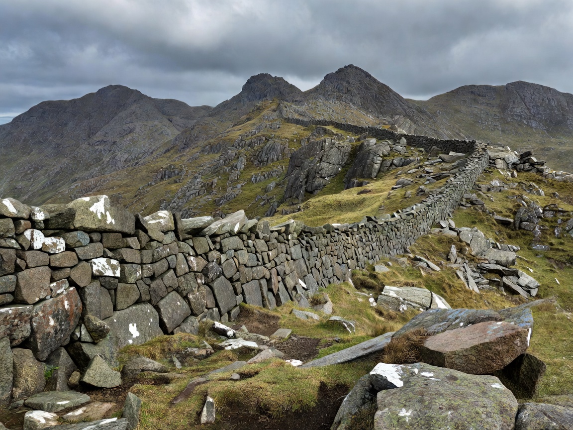
Granite Ridges, Mountain Walls & Sea Vistas
Nowhere else in the British Isles do mountains drop so directly into the sea as in the Kingdom of Mourne. Walk along the historic Mourne Wall for vistas spanning five kingdoms.
Geological Elevation and Atmospheric Sightlines
Northern Ireland presents two distinct upland landforms: the granite plutons of County Down (the Mourne Mountains) and the extensive volcanic flood-basalt plateaus of Counties Antrim and Londonderry (including Binevenagh and the Sperrins).
Because the province has relatively narrow landmass dimensions surrounded on three sides by ocean, summits under 900 metres yield sightlines that extend over hundreds of square kilometres. On clear days following an Atlantic cold front, walkers standing on high points can clearly observe the Isle of Man, the Galloway hills of Scotland, the Wicklow Mountains south of Dublin, and the distant peaks of Donegal.
Four Exceptional Mountain Viewpoints Evaluated
Hare’s Gap & Ben Crom (Mourne Mountains)
Elevation & Terrain: 440m col elevation, passing through dramatic granite crags. The most spectacular mountain pass in Ulster, dividing the outer peaks from the Silent Valley catchment.
- Visual Reward: Amphitheatre panorama of the Ben Crom reservoir, Slieve Binnian, and towering granite tors.
- Difficulty: Strenuous final ascent through steep boulder fields; uneven granite scree requiring solid ankle support.
Binevenagh Escarpment (County Derry/Londonderry)
Elevation & Terrain: 385m precipice formed by ancient post-glacial landslips, where vertical basalt cliff faces drop into rolling agricultural lowlands.
- Visual Reward: Vast 180-degree view encompassing Magilligan Point, Lough Foyle, Inishowen Peninsula, and the Atlantic Ocean.
- Difficulty: Approach via forest road is moderate; cliff top is unfenced with sheer, exposed drops.
Slieve Donard Summit (County Down)
Elevation & Terrain: 850m (the highest peak in Northern Ireland). Ascends alongside the Glen River from Donard Park in Newcastle directly to the summit stone cairn and Mourne Wall watch tower.
- Visual Reward: 360-degree panorama of Dundrum Bay, the Irish Sea, the inner High Mournes, and Lough Neagh.
- Difficulty: High stamina demand; 850m sustained ascent over 4.6 km one-way; severe wind chill at summit.
Divis and the Black Mountain (Belfast Hills)
Elevation & Terrain: 478m heathland plateau managed by the National Trust, offering a complete aerial overview of Belfast Lough and Mournes.
- Visual Reward: Exceptional ratio of reward to effort; views stretching from Strangford Lough across to Scotland.
- Difficulty: Gentle gravel pathways; exposed to wind and horizontal rain; wet heath off the established trail.
Technical Route Breakdown: Hare’s Gap from Trassey Track
For intermediate hillwalkers seeking dramatic scenery without committing to Slieve Donard’s strenuous sustained elevation gain:
- Trailhead: Trassey Road car park (GR J312314).
- Distance: 7.2 km out-and-back.
- Vertical Gain: 290 metres.
- Route Profile: Follow the historic quarry road south along the Trassey Track, passing between the lower slopes of Slieve Meelmore and Spellack. At the head of the valley, follow the rough stepped granite trod climbing directly to the Mourne Wall at Hare’s Gap.
- Hazards: High winds channel violently through the gap col; ice formation on granite blocks between December and March.
Mountain Safety and Upland Ethics
The Mourne Mountains and Sperrins present genuine upland conditions despite their modest absolute height. Mountain Rescue teams in Newcastle frequently assist walkers caught unprepared by sudden mist or early darkness:
- Always carry a physical topographic map (1:25,000 OSNI Mournes Activity Map) and magnetic compass; do not rely solely on mobile smartphone displays.
- Carry emergency windproof shell layers, a warm fleece mid-layer, head torch with spare batteries, and high-energy rations.
- The Mourne Wall is a dry stone structure built between 1904 and 1922. Do not dislodge granite stones or climb over the wall except at designated ladder stiles.